← Is This What Population-centric Counterinsurgency Looks Like?
A new way forward | re-thinking us stratergy in afghanistan
REPORT OF THE AFGHANISTAN STUDY GROUP www.afghanistanstudygroup.com RSS FEED

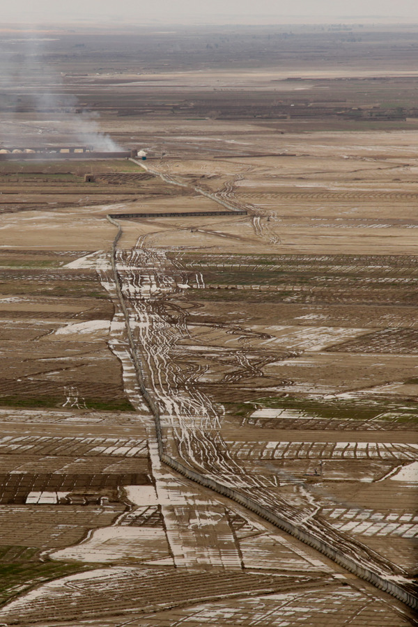
Concrete barriers dubbed the “Great wall of Kandahar” cut through flooded farmland in Zhari district, west of Kandahar City. US troops from the 101st Airborne Division are planning to build a wall 50 miles long to prevent the Taleban from attacking Highway One, the road which links Kandahar with Kabul, Helmand and Herat. During recent rains sections of the wall acted like a dam, flooding fields on one side and starving those on the other of water. At least 56 concrete sections were washed away because there were no culverts in the original plan – because insurgents could use them to plant bombs or sneak through.
Bookmark the permalink.